coastalnavigation.com

Section 1

Getting Started

 
cdn

1.4

Publications


A boater in Canadian waters should be aware of Canadian nautical publications. Many of these, including up-to-date charts, must be on board for safety's sake when cruising (it may be required by some insurance companies). Here are some of the main publications:

Chart No. 1: Symbols, Abbreviations and Terms Used on Nautical Charts, known as Chart 1, is a directory that organizes the symbols, abbreviations and terms used on Canadian nautical charts. The United States has its own version of this publication, also called Chart 1.

Notices to Mariners (NOTMARS in Canada, NOTAMS in the USA) provide updated information for charts and other marine publications. It especially draws attention to new hazards. In Canada and the US, Notices is published for regions or districts and is available in print form and on the Internet.

Canada: (Link unreliable: Search on notmar canada)
US: http://www.navcen.uscg.gov/?pageName=lnmMain

Sailing Directions contain information on channels and courses, dangers and obstructions, reefs and shoals, marinas and local services, navigational aids, weather, rules of the road and so on. They are produced in Canada by the CHS. Separate publications cover the Great Lakes, the larger inland waters and the east and west coasts. Sailing Directions are primarily for use by commercial vessels but provide much information for recreational boaters. In the US the equivalent publications are called Coast Pilots.

Small Craft Guides are specifically for operators of small boats and contain safety and piloting information for a given area. They provide detailed navigational and geographical information, a list of services and facilities available to the recreational boater, weather broadcast data, and tables of distance, tidal, and weather information.

Tide Tables

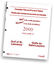
Tide and Current Tables are published in several volumes each year by the CHS. They cover Canadian tidal waters. Tidal tables give the predicted times and heights of high and low tides. Current tables provide predicted times for maximum current and slack water.

Collision Regulations, also known as the Colregs, are properly entitled the International Regulations for Preventing Collisions at Sea, 1972 with Canadian Modifications. They detail piloting and technical requirements, by regulation under the Canada Shipping Act, for mariners and vessels in all conditions. The US produces a similar Colregs publication that includes modifications for US inland waters.

Local Rules and Regulations (municipal regulations) cover such harbours as Toronto's and Vancouver's where special rules are in force due to the volume of boating traffic.

List of Lights, Buoys and Fog Signals is dubbed the Lights List. It gives the latitude and longitude, by region, of aids to navigation and a description of their appearance and light characteristics.

Cdn Nav Aids

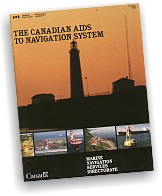
The Canadian Aids to Navigation System provides detailed information on navigational aids including a reference chart for fixed aids and buoys.

Radio Aids to Marine Navigation is similar to the Lights List except that it covers radio aids: their frequencies, locations, Morse code identifiers and broadcast ranges.

Safe Boating Guide is a handy, free publication for recreational boaters that covers safety issues and regulations in non-technical language.

Sources

Official Canadian boating publications can be purchased at:

chart and map dealers
marine stores and chandleries
other specialty stores such as dive shops
government retail publication outlets


The Sail Canada Coastal Navigation Standard

2. Identify a source of official Canadian government navigation publications.
3. List the publications required for prudent navigation in the local area.


© 2020 coastalnavigation.com - Canadian Edition