Section 1Getting Started |
||
| HOME MAIN TOCHELP |
Section 1Getting Started |
||
| HOME MAIN TOCHELP |
1.5 |
The Navigatior's Toolbox |
|
Coastal navigation requires a few simple tools. Some have changed little over hundreds of years of sea travel and others take advantage of modern electronics to improve accuracy and performance. Navigational tools can be divided into two types: those to gather information about positions, headings, courses and bearings and those to plot the information on a chart. The brief description below describes the tools that you, as a navigator, should have on board. The compass, depth sounder and knotmeter are used to gather information. The dividers, plotters and parallel rulers allow you to plot the information on a chart. You will practice using them later in the course. |
Steering CompassA steering compass allows a helmsperson to maintain a course. It's mounted where it can be read easily: near the centreline of the boat or on a bulkhead, instrument panel or binnacle. Traditional compasses are still widely used although electronic compasses with digital displays are becoming increasingly popular. |
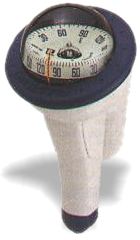
Hand-held CompassThe function of a hand-held (or hand-bearing ) compass is to determine the direction of an object. It is held upright and aimed at a buoy, for example, and the direction or bearing, is read from the display or compass card. Like the steering compass, a hand-held compass can be mechanical or electronic.
|
 |
ClockAn accurate clock or watch does more than tell time. Knowing how long it takes to get somewhere allows you to determine your speed and distance traveled. |
Depth SounderA depth sounder warns of shoaling and underwater obstructions. It can also help you to determine your position when readings are compared with charted depths or soundings. KnotmeterA knotmeter is the mariner's speedometer. It displays the speed in knots (nautical miles per hour) of your boat through the water. With speed and time known, you can calculate distance traveled. |
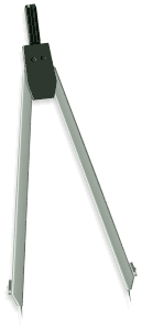
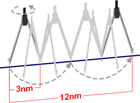
DividersDividers enable you to measure distance on a chart and to transfer plotted positions to and from the latitude and longitude scales. You can vary distances by adjusting the span of the moveable legs. When a plotted line is longer than the span, the legs can be set to a specific distance and "walked" along the line. Note: Dividers are included in your student kit. |
|
|
|
|
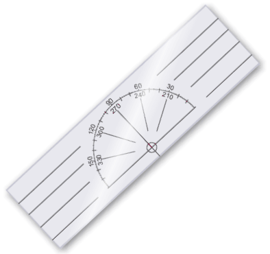
Course PlottersThere are a number of protractors that can be used to draw directions on a chart. The course plotter is one of the handiest. The cockpit plotter, known as the Douglas protractor, is also popular. These plotters use a meridian of longitude as the reference to true north. A line in any direction can be plotted accurately from any point on the chart. You will have opportunities to practice using the course plotter beginning in section 5. Note: A course plotter is included in your student kit. |
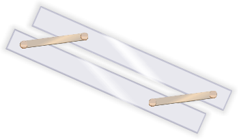
Parallel RulersAnother tool for plotting courses, headings and bearings is the parallel rules or ruler. It transfers direction from the chart's compass rose. When using parallel rules, the chart has to be on a flat surface, and show a compass rose as well as the area where you're plotting. |
|
Pencil and EraserPlotting should be done with a wooden or mechanical pencil using an HB or B lead. The need for a good eraser becomes obvious early in a navigator's career. |
|
||||||
| MAIN TOC SECTION TOCPREV LESSONNEXT LESSON HELP |